Point San Luis Lighthouse - MAP
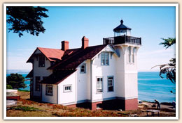
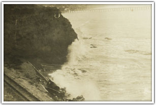
Even though the need for a lighthouse was obvious because by 1870 Port Harford was averaging over 400 ships per year, it wasn’t till a near disaster of a ship hitting the pier (then ran aground) that put everyone on the same page. The Point San Luis Lighthouse was completed in June 1870 and was lit for the first time on June, 30th 1890. It helped guide ships for 84 years before the Coast Guard closed the lighthouse in 1974. In 1992 the Port San Luis Harbor District was given the Point San Luis land site from the Federal Government as long as they restored the lighthouse and opened it to the public. It has been fully restored by the Point San Luis Lighthouse Keepers and is currently open for public tours by a docent lead hike or trolley tours.
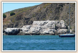
Pillow Basalt (Lava Rocks in the Port) -MAP

These rocks are Pillow Basalt. They are formed with hot lava is extruded underwater. Underwater extrusion of lava is not the same as pouring lava into the sea. Pouring lava causes it to shatter into sand-sized pieces; the source of the “black-sand” beaches of Hawaii. If one walks out along the base of the cliff (low-tide only), the toothpaste-like structures is obvious. Look closely and you will find a couple of 1”+ bore holes; drilled into this rock, obviously man-made. Here’s the story: Black rocks contain black minerals which contain iron.
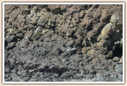
When the liquid lave hardens (crystallizes) the iron minerals line up with the earth’s magnetic field. That magnetic movement is locked in these rocks forever (as long as they are not re-heated). If one cuts a core from the rock and marks its orientation, one can take the core back to a lab. Now, we must have an apparatus which can shield the core-sample from all outside magnetic fields. The very tiny field, locked in the minerals, can be read. It yields the latitude (north of the equator) but not the longitude (east-west direction). This pillow basalt was formed very close to the equator. It has drifted into the Port San Luis Harbor through plate-tectonics.
Whalers Island - MAP
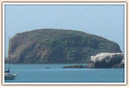
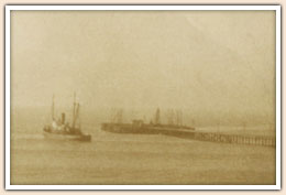
Whalers Island is now incorporated into the break water. In the 1800’s it was an active whaling station. During the whaling migration (November-April) a lookout was stationed above the lighthouse. Boats would row out and attempted to harpoon the whale, which was towed back to the island where the blubber was stripped. On shore were 1500 gallon pots in which blubber was boiled down to oil. Ten whales would pay for a season. Whale oil lubricated the Industrial Revolution. Whaling preceded petroleum, and vegetable oil will not hold up to the stress of heat and shear; whale oil was the answer.
- MAP
For ten years, starting in 1884, the Smith family lived on this island. They were followed by two families of Gregory’s; one with 14 children. The bridge connected the island to the land where boats were stored. There were decks cantilevered over the cut terraces.